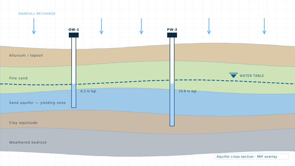
Groundwater Study
Aquifer characterisation, recharge potential mapping and water level trend analysis.

Non-invasive subsurface investigation that tells you what is below before you commit to drilling or foundation design.
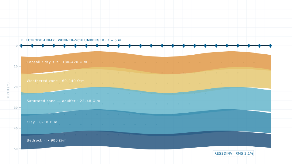
Resistivity surveying measures how readily the ground conducts current, which changes sharply between dry soil, saturated sand, clay and rock. Interpreting that contrast gives you a layered picture of the subsurface without a single borehole.
We run vertical electrical sounding where a one-dimensional layer model is enough, and two-dimensional imaging where lateral variation matters — a fracture zone, a saline wedge, or a landfill plume. Field data is inverted in RES2DINV or IPI2Win and interpreted alongside available lithological logs.
If a survey is more than the job requires, the data store lists 84 licensable imagery, elevation and vector products.
Aquifer characterisation, recharge potential mapping and water level trend analysis.
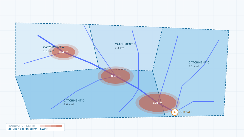
Catchment delineation, storm-water network modelling and flood risk mapping.
Send the site extent and the accuracy you need. We will come back with a scope, a deliverable list and a price.