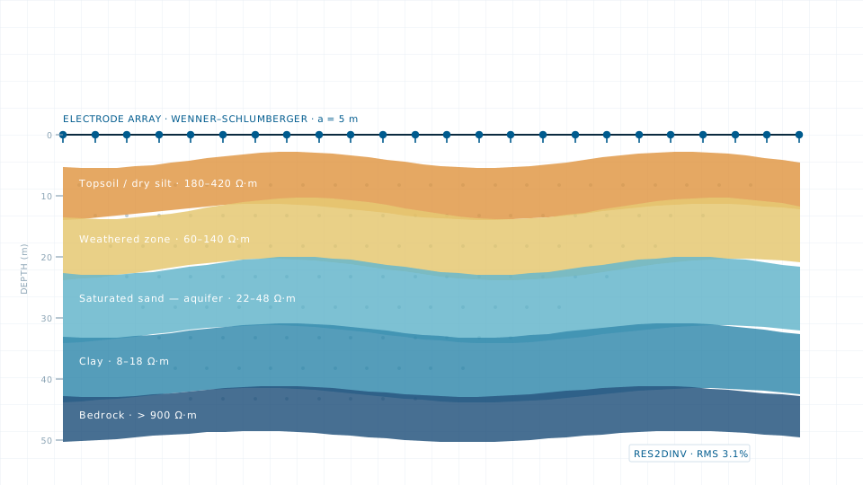
Electrical Resistivity Survey
VES and 2D imaging to resolve aquifer depth, bedrock profile and contamination zones.

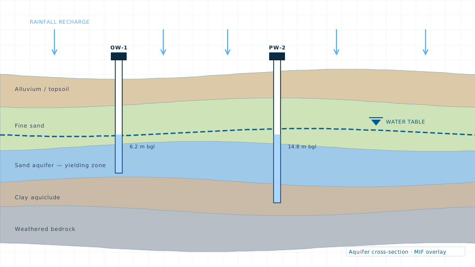
Source sustainability decisions get made on thin evidence far too often. A groundwater study builds the evidence: water level records from observation wells, lithology from available logs and resistivity sounding, rainfall and land cover from satellite time series, and terrain and drainage from the DEM.
These layers are combined by a weighted overlay — multi-influencing factor or analytic hierarchy process — into recharge potential and groundwater prospect maps, with the weighting method documented so a reviewer can follow the reasoning.
If a survey is more than the job requires, the data store lists 84 licensable imagery, elevation and vector products.
VES and 2D imaging to resolve aquifer depth, bedrock profile and contamination zones.
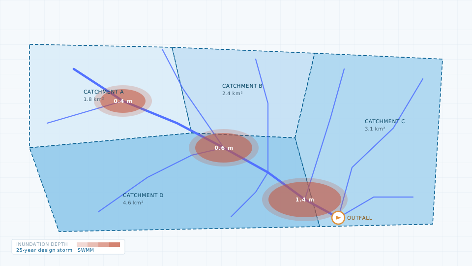
Catchment delineation, storm-water network modelling and flood risk mapping.
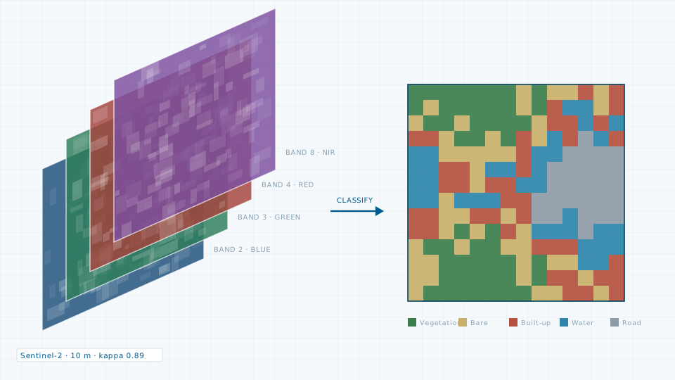
Land use classification, growth series, urban heat and change detection.
Send the site extent and the accuracy you need. We will come back with a scope, a deliverable list and a price.