
NagarMatrix Ventures Pvt Ltd | Urban geospatial services & municipal software
+91 95023 53944|info@nagarmatrix.com
Home/Software

Municipal software

Spatial data earns its cost only when a clerk, an engineer and a citizen can all act on it. Our municipal platform runs on the same verified base map we survey — one source of truth for revenue, service delivery and citizen access.

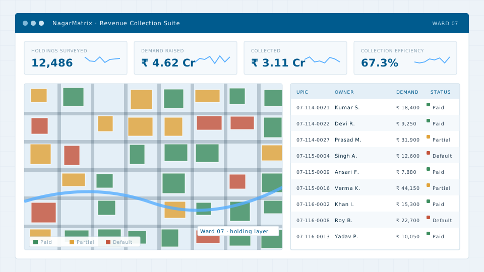
Municipal revenue platform — ward dashboard, holding layer and demand register
The platformWard dashboard, holding layer and demand register in one view. Illustrative interface with sample data.

Three systems, one base map

Revenue Collection Suite

Property, water, trade licence and advertisement demand generated against surveyed parcels, closing the gap between what a city owns and what it bills. Field collection runs on a mobile application with offline capture, and every receipt carries an audit trail.

GIS-linked demandField collectionDigital receiptsAudit trailDefaulter tracking

Citizen Services Portal

A single gateway for birth and death certificates, trade licences, building plan applications, grievances and bill payment, with service level tracking on every request and escalation when a deadline passes.

CertificatesGrievance SLAOnline paymentHindi & EnglishMobile-first

Resource & Workforce Management

Route-optimised waste collection, attendance and asset tracking for sanitation and revenue staff, mapped against ward boundaries and household counts so coverage can be measured rather than assumed.

Route optimisationVehicle trackingAttendanceWard dashboards

Built on surveyed data, not on a spreadsheet

Municipal software usually fails for the same reason everywhere: the underlying record is wrong. A property tax module is only as good as the parcel layer beneath it, and a waste collection route is only as good as the road network it is drawn on.

Because we survey the base data ourselves, the platform starts from a verified map rather than a legacy register. Parcels carry a unique identifier that links the map to the demand, so a change on the ground can be reflected in the bill.

Deployment and handover

Systems are deployed on infrastructure located in India, configured to the local bye-laws and fee schedules, and handed over with documentation and staff training. Data export is unrestricted — the municipal record belongs to the municipality, and we do not hold it hostage to a contract renewal.

Integration

  • OGC-compliant map services, so any GIS client can consume the layers
  • REST APIs for integration with state portals and payment gateways
  • Bulk import from existing registers, with a reconciliation report
  • Export to SHP, GDB, GeoJSON, CSV and PostGIS at any time
Arrange a demonstration

Want to see the platform running on your own ward?

Send us a sample of your existing register and we will load it into a demonstration instance.