NagarMatrix Ventures Pvt Ltd | Urban geospatial services & municipal software
+91 95023 53944|info@nagarmatrix.com
Home/Services/Remote Sensing Analysis

Remote Sensing Analysis

The analytical layers that turn imagery into an argument a plan or a paper can rest on.

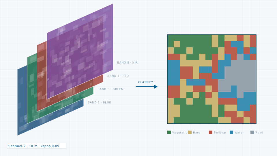
Remote Sensing Analysis — illustration of a typical deliverable
Typical deliverableMultispectral band stack classified into land cover, with accuracy assessment reported.

Imagery on its own rarely settles a question. Classification, change detection and index analysis do. We build multi-date land use and land cover classifications with accuracy assessment reported, decadal built-up growth series that show the direction and rate of expansion, and thermal series that locate heat island hotspots.

Analysis runs on Google Earth Engine and open-source Python stacks, so the workflow is reproducible and can be re-run when new imagery arrives rather than rebuilt from scratch.

What you receive

  • Supervised land use and land cover classification with class definitions
  • Accuracy assessment: confusion matrix, producer and user accuracy, kappa
  • Change detection matrices between date pairs, with area statistics
  • Built-up extent time series with sprawl and direction metrics
  • Land surface temperature and vegetation index rasters
  • Chart pack and technical note ready for a report or a paper

Specification

Imagery sources
Sentinel-2, Landsat, Cartosat, and commercial VHR where required
Classification
Supervised — random forest, SVM and maximum likelihood as appropriate
Accuracy reporting
Confusion matrix and kappa coefficient always reported
Indices
NDVI, NDBI, NDWI, LST, and others on request
Platform
Google Earth Engine, QGIS, Python geospatial stack
Output formats
GeoTIFF, SHP, CSV statistics, PDF report

Typical applications

  • Master plan existing land use
  • Urban growth projection
  • Heat island and climate action planning
  • Encroachment and change monitoring
  • Academic and peer-reviewed research
Request this service
Quote turnaround2 working days

Need the data instead?

If a survey is more than the job requires, the data store lists 84 licensable imagery, elevation and vector products.

Open the data store

Related services

Groundwater Study

Groundwater Study

Aquifer characterisation, recharge potential mapping and water level trend analysis.
Urban Planning

Urban Planning

Master plans, land use plans, zoning schemes and Local Area Plans.

Planning a remote sensing analysis?

Send the site extent and the accuracy you need. We will come back with a scope, a deliverable list and a price.